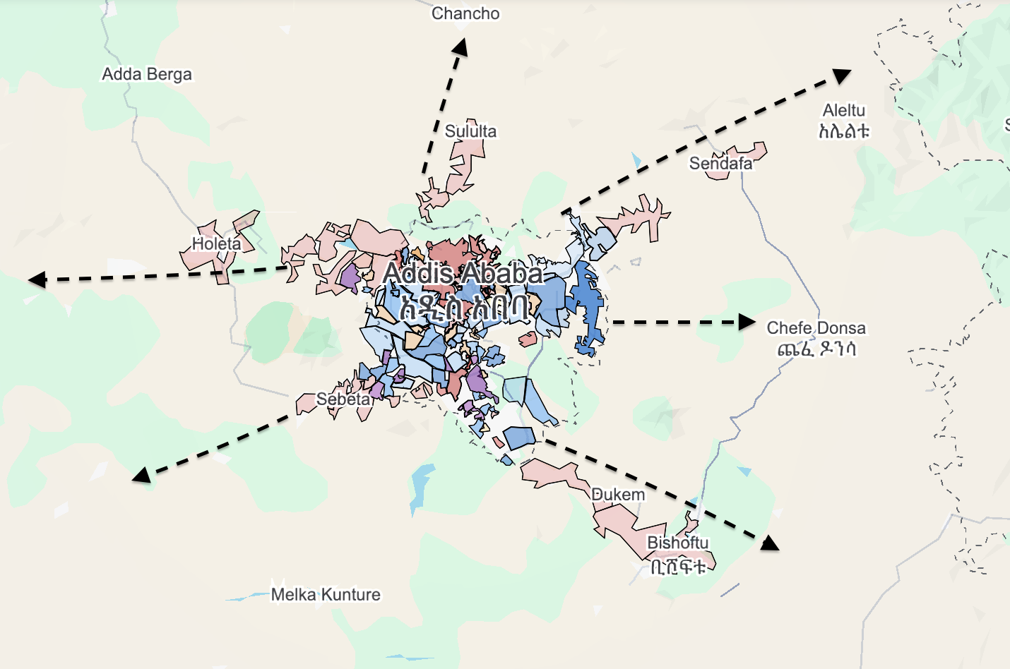
1. The "Ring of Steel" (Shegar Belt)
The Shegar subcities act as a buffer zone. To reach the heart of Addis Ababa, an insurgent force must first penetrate or bypass these fortified urban hubs.
•
Checkpoints and Chokepoints: The black arrows on your map represent the main arterial roads (like the A1 and A5). These are now heavily monitored at multiple points. An armed group can no longer simply "drive" into the capital; they would face high-intensity urban combat in cities like Sululta or Bishoftu before even seeing the Addis Ababa city limits.
•
The Fortress Effect: By grouping these towns under one administration, the government has unified the security command. A threat detected in Sendafa (northeast) triggers an immediate response from the entire eastern sector of the Shegar police and military commands.
2. Aerial Superiority and "Eyes in the Sky"
Modern urban warfare in Ethiopia is defined by technology.
•
Bishoftu (Air Force Hub): As seen on your map to the southeast, Bishoftu is the home of the Ethiopian Air Force. This proximity allows for near-instant deployment of drones and fighter jets.
•
Drone Logistics: Because Addis and Shegar are so closely knit, the government can maintain 24/7 drone surveillance over the "empty" spaces between the subcities. Any large-scale movement of OLF or Fano troops through the hills or plains would be spotted and struck from the air long before they reached the urban "built-up" areas.
3.
Geographical Barriers
•
The Entoto Range (North): To the north (near Sululta), the Entoto Mountains provide a natural defensive wall. The government holds the high ground. For Fano militias coming from the Amhara region, they must fight uphill against entrenched federal forces equipped with heavy artillery.
•
Urban Sprawl: Insurgent groups typically thrive in rural "guerrilla" settings. Addis and Shegar are now so densely built that they require "conventional" urban warfare capabilities—tanks, high-tech communications, and massive manpower—which militias like OLF and Fano generally lack.
4.
The Political "Fortress"
As discussed earlier, the Oromo Prosperity Party (OPDO) has integrated its political survival with the physical infrastructure of these cities.
•
Revenue and Resources: The government extracts the taxes needed to pay for the military (ENDF) from these very cities.
•
Intelligence Networks: In high-density areas like Burayu or Sebeta, the government maintains deep local intelligence networks (the 1-to-5 system or neighborhood watches). It is nearly impossible for an insurgent group to "infiltrate" the city in large numbers without being reported by local cadres or security-minded residents.
Why OLF and Fano Struggle
•
OLF (OLA): Their strength is in the forests and rural hinterlands of Western and Southern Oromia. Moving into the Shegar belt forces them into "clear" territory where they lose their camouflage and are vulnerable to the drones stationed in Bishoftu.
•
Fano: Their power base is the Amhara highlands. To hit Addis, they must cross the Abay (Blue Nile) Gorge or the North Shewa plains—wide-open spaces where the ENDF can use its technological superiority (mechanized divisions and air power) to devastating effect.