This is the source: https://zenodo.org/record/6480926
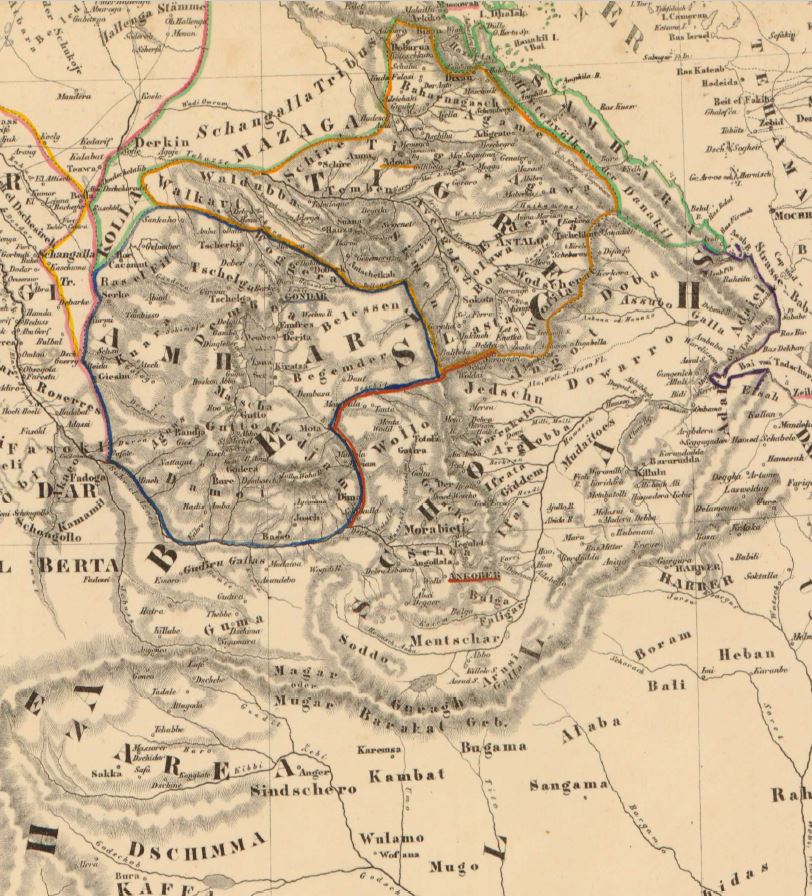
The map shows not only Wolkait Humora but the Tembien province, Agame province and Bahrenegash province.
Thanks to Estonia, Germany and USA Stanford University archives to show clearly and very well defined Amhara and Tigray provinces. The Sudan boundary is clearly shows too. Alfashiga is pure Tigray and other eastern Sudan.
Amhara Sew Teblish Degmo, waiting until Oromia take its part and stand alone and what we can do to you, Borqaqa???
I didn't know you could speak Tigrigna.TGAA wrote: ↑24 Apr 2022, 20:44The Knuckleheads don't even remember Amhara as Admintrative region come into being after chenawit came to power in 1990s, but the munfucture a map dated 1840 that shows Amhara region. Begamder, Gojam, shewa there was no Amhara moron weyannes and their lampoon white poodle from Manchester.


